|
| |||||||||||||||||||||||||||||||||||||||||||||||||||||||||||||||||||||||||||||||||||||||||||||||||||||||||||||||||||||||||
| |||||||||||||||||||||||||||||||||||||||||||||||||||||||||||||||||||||||||||||||||||||||||||||||||||||||||||||||||||||||||
 |
Astronomy Information
SunSunrise: 7:09 am Sunset: 4:28 pm Daylight: 09:19 |
MoonMoonrise:10:12 pm Moonset: 11:21 am 66% illuminated |
| First Quarter Moon | Full Moon | Last Quarter Moon | New Moon |
 |
 |
 |
 |
| 15:27 UTC December 8 2024 | 09:02 UTC December 15 2024 | 22:19 UTC December 22 2024 | 06:22 UTC December 1 2024 |
Space Weather Observations, Alerts, and Forecast
3-day Solar-Geophysical Forecast
forecast is not available
Real Time Images of the Sun
SOHO EIT 304
|
SOHO EIT 284
|
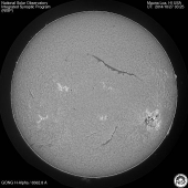
Mauna Loa Solar Image
|
Real Time Solar X-ray and Solar Wind
LASCO Coronagraph
WSA-Enlil has become an important tool for forecasting the impact of Coronal Mass Ejections and the effects of the Solar Wind on the Earth. |
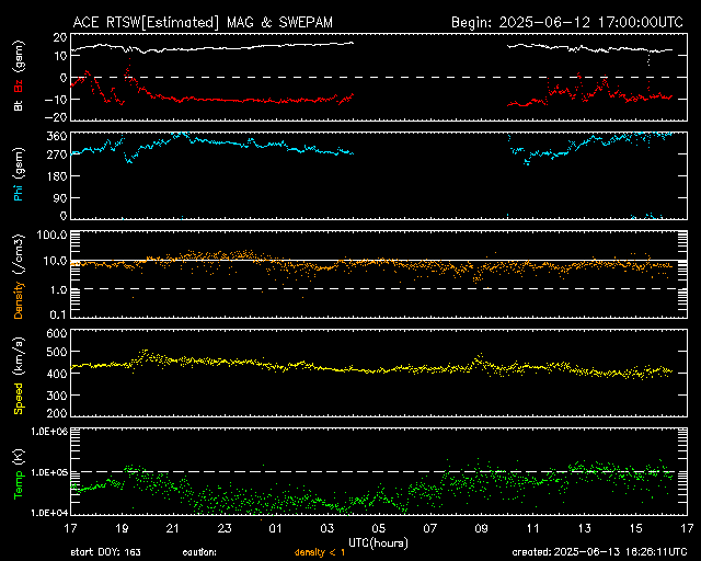
Real-Time Solar Wind
Real-Time Solar Wind data broadcast from NASA's ACE satellite. |
Solar X-ray Image Observations of solar X-rays aids in the early detection of solar flares. |
Active Region Active Region (AR) using the 'BE12a' wavelength filter and a 1 second integration time setting over a period of 24 hours. |
Auroral Activity Extrapolated from NOAA Ovation Prime Model
Northern Hemisphere Map
|
Southern Hemisphere Map
|
Credits:
Space Weather Images and Information (excluded from copyright) courtesy of: NOAA / NWS Space Weather Prediction Center, Mauna Loa Solar Observatory (HAO/NCAR), and SOHO (ESA & NASA).Space Weather links:
3-Day Forecast of Solar and Geophysical Activity
Space Weather Now
Today's Space Weather
Real-Time Solar Wind
Space Weather Outlooks
Space Weather Bulletins
Space Weather Alerts and Warnings
Space Weather Alerts - Current Month
Solar and Heliospheric Observatory (SOHO)
The Very Latest SOHO Images
Star Chart for the Illiana Area
Your Sky planets and constellations at Sat, 21-Dec-2024 11:32am UTC |
|
|||||||||||||||||||||
| Monthly SkyMap |

| Color Key |
| Worse | Better | Best | Sky (including Wind) | ||||||||||
| Worse | Best | Worse | Ground |
Space Track-Satellite Passes
Satellite Ground Trace courtesy:
Heavens-Above.com
Bright Satellite List for your location.
Script courtesy of: Lee from MadALwx. Page template and Facts script courtesy of: TNET Weather.
Page Template and Moon script courtesy of: Saratoga Weather.
Bright Satellite List for your location.
Notes about viewing ESVs:
When using lookangles, choose passes with high magnitudes; less than 6.0. ("Looks" are local time.)
Best viewing is when ESV is in Earth's penumbra; on the map, it's the solid line during night.
Dotted line on map denotes ESV is dark, in Earth's umbra (shadow).
Objects in orbit have to maintain a speed of at least 17,500mph, therefore ESVs traverse the sky noticeably different than aircraft.
ESVs appearing to blink are either tumbling rocket bodies, or spinning payloads with deployed solar arrays.
High-Eccentricity objects have a more ellongated orbit. Ground trace looks like a backwards C.
Regression-Ground traces will move West with each orbit due to Earth's rotation.
Script courtesy of: Lee from MadALwx. Page template and Facts script courtesy of: TNET Weather.
Page Template and Moon script courtesy of: Saratoga Weather.


